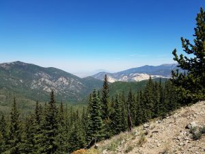
From the Winter 2019 Collegian | On a mountain just outside of Taos, New Mexico, a group of students sits, taking a break after hiking up the steep slope. They take in the blue skies, the unique wildlife, and the picturesque views before capping their water bottles and heading up the next stretch. But this isn’t just hiking and sightseeing in the great outdoors—it’s their classroom for the next few weeks.
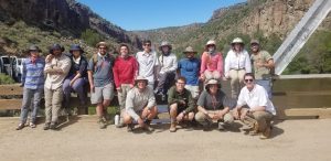
Each summer, UA’s department of geological sciences sends a group of undergraduate students to New Mexico for field camp, where their years of coursework will be put to the test over 1,200 miles away from campus. Over the course of five weeks, these undergraduates practice field skills they’ll use in their future careers as geologists.
“You can learn a lot of things in the classroom, but until you go out in the field, and actually do it and actually see rocks and draw maps, then you don’t get the full experience,” said Dr. Kim Genareau, an associate professor and director of the field camp. “I think it’s one of the best learning experiences students can have.”
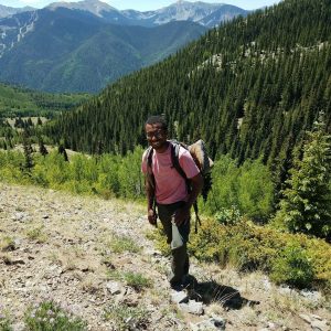
At their base camp, the Austing Haus Ski Lodge, students learn the ins-and-outs of geological mapping, manually measuring formations, and navigation before they embark on their journey. Once they’ve learned the ropes, they venture out into the wilderness to explore different types of rocks and formations, all while hiking between two and seven miles a day up and down the mountains, and camping at night for some of the time.
“We would hike around the area for about three to five days, taking notes on the different minerals, rock formations, and geological structures that we saw,” said Mark Henry, a current geological sciences master’s student and participant in the 2018 field camp. “Then we would make a note of where they were located and use that to construct a geological map of the area. It was really cool to see how everything came together while you made your map.”
The trip consisted of three different segments involving the different types of rocks: sedimentary, metamorphic, and igneous. Each segment was led by a different professor and allowed the group to become acquainted with the type of rock they were studying before moving onto the next. Graduate teaching assistants, who stayed with the undergraduates throughout the camp, offered guidance and advice while the undergraduates became more comfortable with their
new skillsets.
“We helped the students with different things that they were learning. And it’s also a learning experience for us,” said Lucas Nibert, one of this year’s graduate teaching assistants. “I learned how to lead students to the right answers through their own thoughts, rather than just giving it to them.”
Throughout the weeks, the group hiked to some of the most beautiful places in the western United States, according to Henry. Professors led them up to the 13,000-foot summit of Wheeler Peak, around the picture-perfect Lake Abiquiu, and even through one of New Mexico’s volcanic craters known as the Valles Caldera.
“The geology in New Mexico is nothing like it is in Alabama,” Genareau said. “And for a lot of students, it’s their first time going somewhere like this. It’s cool to see volcanic deposits that are a million years old, and then seeing the landscapes and all the different animals and insects that are out there. It’s a really great experience for them to see somewhere new.”
While taking in the beauty of their summer classroom, the group put their geology skills to the test, gathering data and information so that, at the end of the week, they could create accurate and complete geological maps of the area.
“Honestly, finding yourself on a map is really difficult,” Henry said. “We always knew where we started, but when we found something we wanted to map, we had to locate where we were so we could make our own maps later in the week. If you mess up your location, your geological map is going to be inaccurate because we make the maps based on topography, or elevation changes. And then making the maps themselves took hours. It was definitely a lot of work, but helpful to know how to do it in the future.”
Once they finished their maps, students and professors explored the Taos area. Some observed the local wildlife, such as big horned sheep, marmots, and beautiful Columbine flowers, while others hiked to see caves, salt flats, and the Rio Grande Gorge, one of the sites that New Mexico is most known for.
After weeks in the mountains, the group made the trek back to Tuscaloosa, where they return physically exhausted, but ready for careers in the field.
“It’s definitely necessary for them to go out west and be able to see some geology because it really helps to tie together all of the conceptual things they’ve been learning,” Nibert said. “Being able to see it and really experience these skills in a hands-on environment— there’s no substitute for it. And it also gives the students a chance to see geology that they’re unable to access here in Alabama.”
“I had never been to a place like this,” Henry said. “But I learned a lot that I think is applicable to any geologists who would ever want to do anything in the field. You learn practical skills, like how to find yourself on a mountain, or how to identify things that are covered by a bunch of trees and branches so that you can barely see. And it was absolutely stunning, too.”